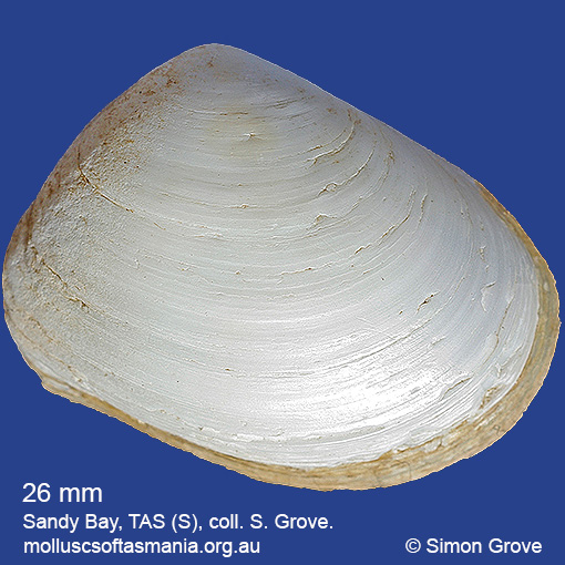
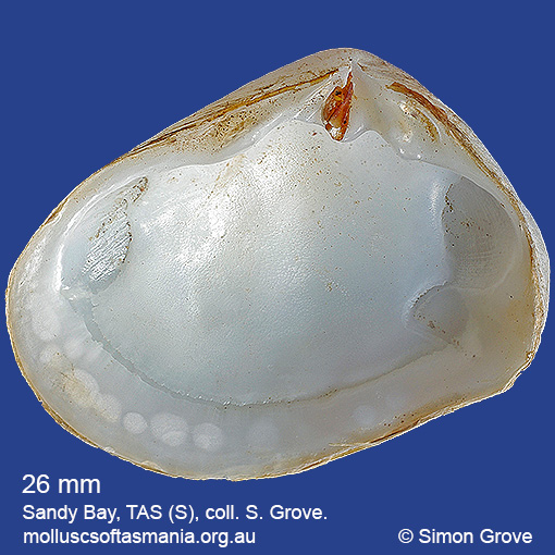
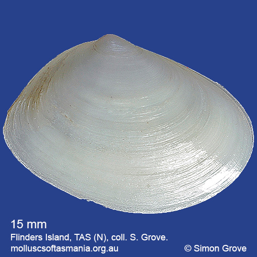
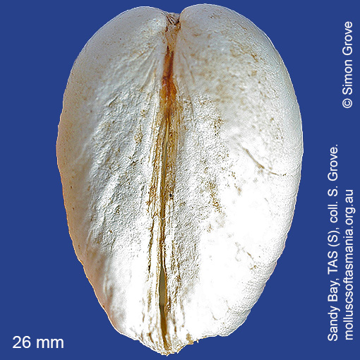
Mesodesmatidae – Mesodesmatinae: Atactodea cuneata (Lamarck, 1818) (‘wedge-shaped wedge-shell’)
Synonym(s): cuneata Lamarck, 1818 glabrella Lamarck, 1818 smithii Gray, 1853 praecisa Reeve, 1854 obtusa Crosse & Fischer, 1864 tasmanica Tenison-Woods, 1876.
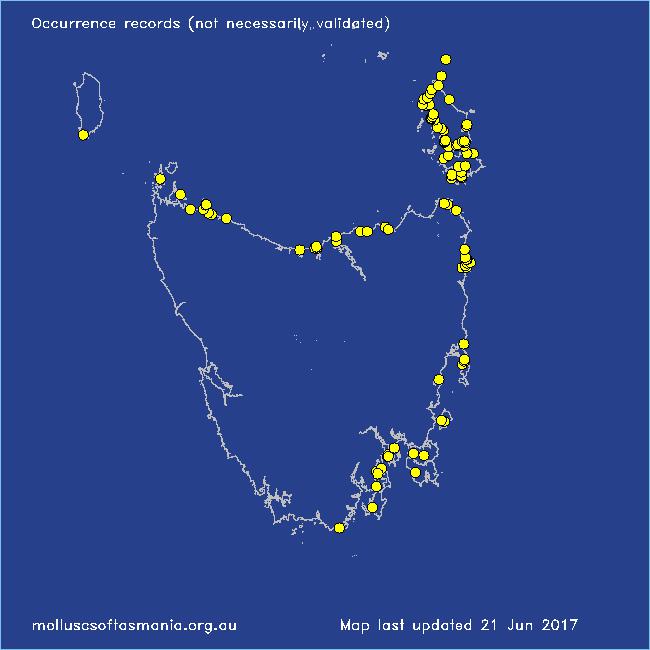
Typical shell-length 25 mm. Pale periostracum readily worn off. Lives intertidally and subtidally in sand and mud, especially on sheltered shores. Native. Endemic to southeastern and southwestern Australia (NSW, TAS, VIC, SA and WA). In Tasmanian waters, this is a widespread species but only locally common, especially so around Flinders Island.
Classification
Class: Bivalvia
Subclass: Heterodonta
Order: Veneroida
Superfamily: Mactroidea
Family: Mesodesmatidae
Subfamily: Mesodesmatinae
Genus: Atactodea
Localities for Atactodea cuneata
Binalong Bay
Binalong Bay: gulches
Bridport: beach
Bridport: Lades Beach
Cape Barren Island: Battery Bay
Cape Barren Island: Kenneth Point: foreshore to E
Cape Barren Island: Kent Bay
Cape Barren Island: Nautilus Cove
Cape Barren Island: Neds Point
Cape Barren Island: SE of Tar Point
Cape Barren Island (unlocalised)
Clarke Island: Black Point
Clarke Island: Black Point – beach to N
Clarke Island: Dip Point to Black Rocks
Clarke Island: Kangaroo Bay to Seal Point
Clarke Island: Maclaines Bay
Clarke Island: Spike Bay
Coles Bay: Honeymoon Bay
Coles Bay: Richardsons Beach
D’Entrecasteaux Channel (unlocalised)
East Devonport: beach & breakwater
Flinders Island: Arthur Bay: Long Point
Flinders Island: Badger Corner
Flinders Island: Beach S of Big River Road
Flinders Island: Boat Harbour Beach
Flinders Island: Cameron Inlet
Flinders Island: Castle Rock beach
Flinders Island: East River Bluff
Flinders Island: Emita: foreshore
Flinders Island: Foochow Beach
Flinders Island: Fotheringate Bay
Flinders Island: Fotheringate Beach: southern end
Flinders Island: Lady Barron: Watering Beach
Flinders Island: Lady Barron: Yellow Beaches
Flinders Island: Leeka: foreshore towards Twelve Hour Point
Flinders Island: Lillies Bay
Flinders Island: Northeast River: mouth
Flinders Island: Palana Beach
Flinders Island: Parrys Bay: Double Corner
Flinders Island: Port Davies & Cave Beach
Flinders Island: Sawyers Bay
Flinders Island: Spences Reef
Flinders Island: Tanners Bay
Flinders Island: Tanners Bay: Pine Scrub
Flinders Island: The Dock
Flinders Island: Trousers Point
Flinders Island: Trousers Point: beach
Flinders Island (unlocalised)
Flinders Island: White Beach to Dick Davey Shoal
Flinders Island: Whitemark Beach
Freycinet Peninsula: Hazards Beach
Friendly Beaches
Georges Bay: Akaroa: foreshore
Georges Bay: Burns Bay
Georges Bay: Humbug Point
Georges Bay: St Helens: foreshore
Georges Bay: Stieglitz: foreshore
Great Dog Island
Hunter Island (unlocalised)
Kettering: Oyster Cove
King Island: S coast (unlocalised)
Lime Bay
Little Musselroe Bay: Lyme Regis Lagoon
Little Musselroe Bay: Tree Point area
Little Peggs Beach
Little Swanport: Saltworks Beach
Low Head (unlocalised)
Lulworth: Tam O”Shanter Bay
Maria Island: Encampment Cove
Maria Island: Riedlé Bay: McRaes Isthmus
Murdunna: Sommers Beach
Musselroe Point
Narawntapu: Bakers Point & Springlawn Beach
Narawntapu: Griffiths Point
North Bruny Island: Killora Bay
North coast of Tasmania (unlocalised)
Nubeena: White Beach
Opossum Bay: Michaels Beach & White Rock Point
Opossum Bay: The Spit & Shelly Beach
Outer Sister Island
Peggs Beach: western end
Ralphs Bay (unlocalised)
Robbins Island: Ransonnet Bay
Rocky Cape: Castle Rock Bay
Shearwater: Freers Beach
Smithton: Duck Bay: Picnic Point
South Arm: Mary Ann Beach & Gellibrand Point
South Bruny Island: Cloudy Bay Lagoon
South coast of Tasmania (unlocalised)
Stanley: foreshore
Stanley: Tatlows Beach
Stanley (unlocalised)
Stanley: West Inlet
Tamar River: Kelso: foreshore
Tasmania (unlocalised)
The Gardens: Coffeys Gulch
The Gardens: Swimcart Beach
Weymouth: beach