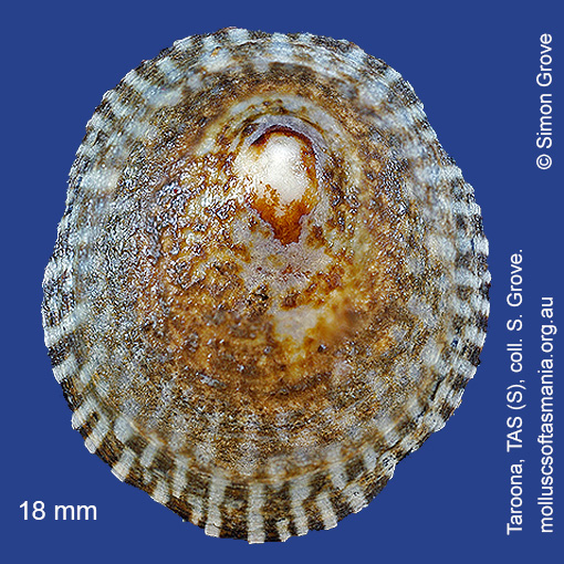
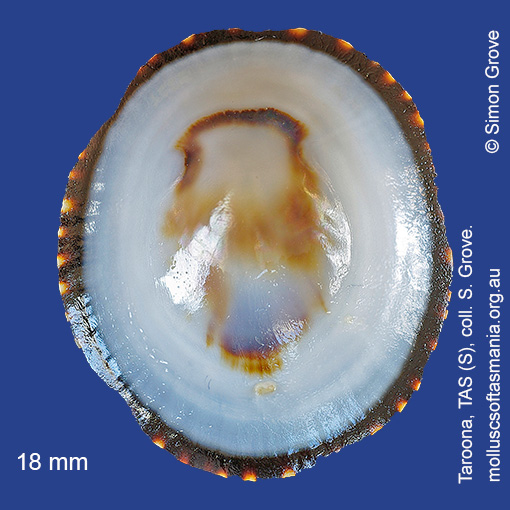
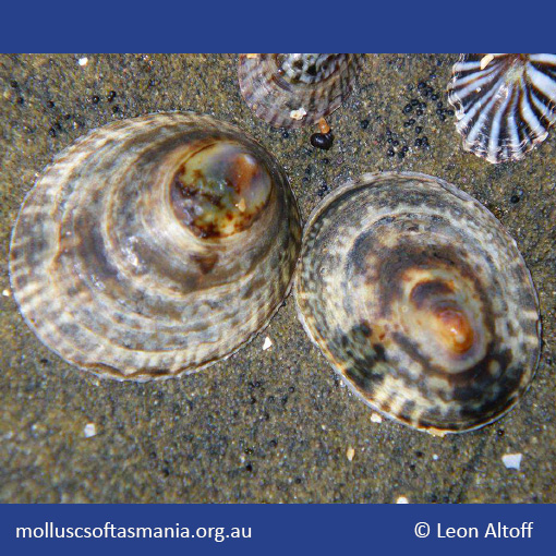
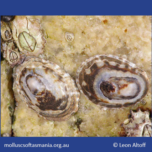
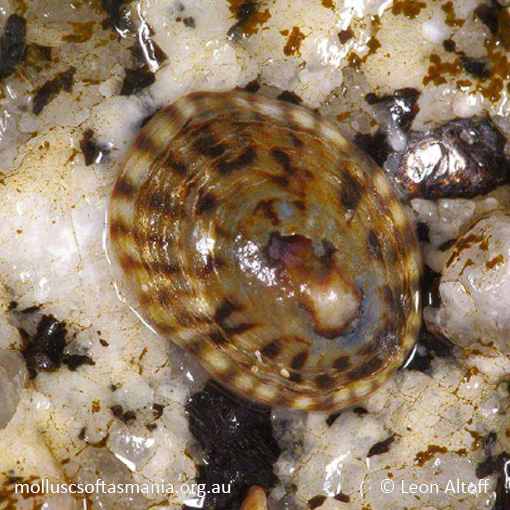
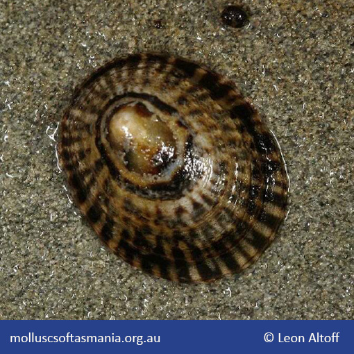
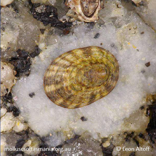
Lottiidae – Lottiinae: Notoacmea petterdi (Tenison-Woods, 1876) (‘Petterd’s limpet’)
Synonym(s): petterdi Tenison-Woods, 1877.
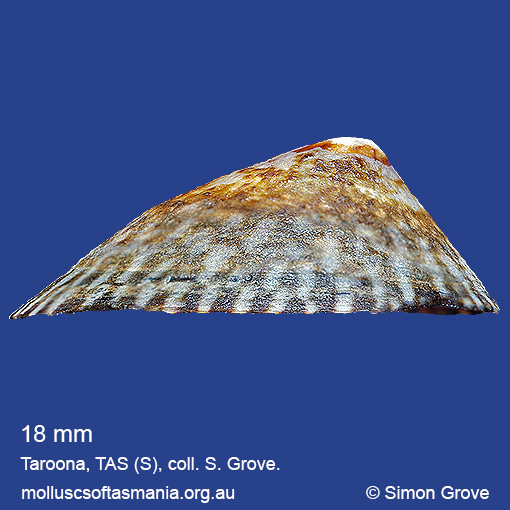
Typical shell-length 20 mm. Shell patterning relatively invariant; underside white with narrow, dark margin. Lives intertidally attached to rocks, generally on overhangs, and especially on moderately exposed shores. Native. Endemic to southern and eastern Australia (QLD, NSW, TAS, VIC and SA). In Tasmanian waters, this is a widespread and often common species, though less so as a beached shell.
Classification
Class: Gastropoda
Subclass: Patellogastropoda
Order: Patellogastropoda
Superfamily: Lottioidea
Family: Lottiidae
Subfamily: Lottiinae
Genus: Notoacmea
Subclass: Patellogastropoda
Order: Patellogastropoda
Superfamily: Lottioidea
Family: Lottiidae
Subfamily: Lottiinae
Genus: Notoacmea
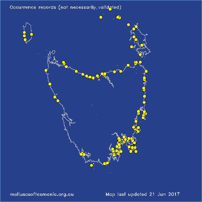
Localities for Notoacmea petterdi
Bathurst Channel: Schooner Cove
Bicheno: Redbill Beach
Binalong Bay: gulches
Blackmans Bay
Boltons Beach
Bridport (unlocalised)
Bruny Island (unlocalised)
Burnie: Blythe Heads & estuary
Cape Portland: Lanoma Point
Cape Portland: Petal Point
Cape Portland (unlocalised)
Chain of Lagoons: Piccaninny Point
Clarke Island: Dip Point to Black Rocks
Clayton: foreshore
Clifton Beach (unlocalised)
Cockle Creek Bay
Coles Bay: foreshore
Coles Bay (unlocalised)
Conical Harbour
Connellys Bay
Cremorne: Pipe Clay Head to Cape Deslacs
Curtis Island
Deal Island (unlocalised)
Dunalley Bay
Dunalley (unlocalised)
Eaglehawk Neck: eastern side
East Devonport: Berth 1
East Wynyard: beach
Eddystone Point (unlocalised)
Falmouth: foreshore
Flinders Island: Arthur Bay: Long Point
Flinders Island: Lady Barron: Watering Beach
Flinders Island: Lillies Bay
Flinders Island: Northeast River: mouth
Flinders Island: The Dock
Fortescue Bay
Frederick Henry Bay (unlocalised)
Freycinet Peninsula: Cooks Beach
Freycinet Peninsula: Wineglass Bay
Garden Island Sands
Goose Island
Granville Harbour: coast to N
Greenes Point
Greens Beach: main beach
Hawley Beach
Hawley Beach: foreshore towards Point Sorell
Hobart: Battery Point
Hogan Island
Huon Island
Kettering: Oyster Cove
King Island: Fitzmaurice Bay
King Island: Halfmoon Bay
King Island: Little Porky Beach
King Island: Naracoopa: foreshore
Lauderdale: Seven Mile Beach
Leith: foreshore
Leith: Lillico Beach
Lime Bay: Green Head
Low Head: East Beach
Maatsuyker Island
Maria Island: Fossil Cliffs
Maria Island: Return Point
Maria Island: Trigonia Corner
Marrawah: West Point
Mercury Passage: Darlington Bay
Middleton: foreshore
Murdunna: foreshore
Narawntapu: Griffiths Point
Narawntapu: West Head
North Bruny Island: Cape Queen Elizabeth
North Bruny Island: Dennes Point
North Bruny Island: Simmonds Bay
North coast of Tasmania (unlocalised)
North West coast of Tasmania (unlocalised)
Nubeena: White Beach
Orford: Emerald Beach
Orford: Shelly Beach (unlocalised)
Orford: Spring Beach
Penguin: Lonah & Lodders Point
Pipers Head
Pirates Bay: The Blowhole
Pirates Bay (unlocalised)
Planters Beach to Fishers Point
Port Arthur: Basket Bay: Remarkable Cave
Port Arthur: Dog Bark Beach
Port Arthur: Ladies Bay
Port Arthur: Point Puer & beach
Port Arthur (unlocalised)
Port Cygnet
Port Davey (unlocalised)
Port Davey: Whalers Cove
Port Latta: Cowrie Point
Randalls Bay
Scamander (unlocalised)
Schouten Island: Sandspit Point
South Bruny Island: Neck Beach: Blighs Rocks
South Cape Rivulet: mouth
Stanley: Circular Head
Stanley: Halfmoon Bay
Stanley: Tatlows Beach
Swansea (unlocalised)
Tamar River: Kelso: foreshore
Taroona Beach
Taroona: Dixons Beach
Taroona: Hinsby Beach
Tasmania (unlocalised)
The Gardens: beach
The Gardens: Cosy Corner
The Gardens: Swimcart Beach
Waterhouse Point