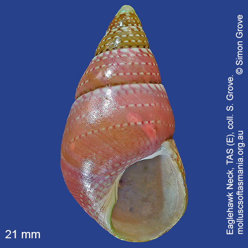
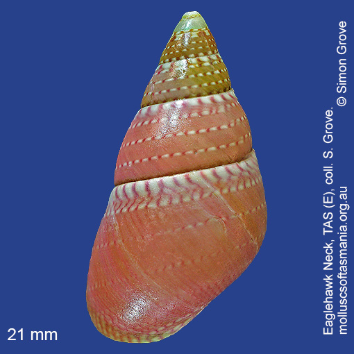
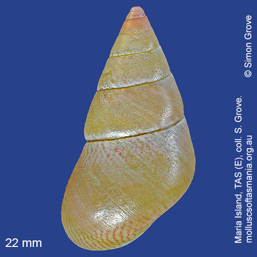
Trochidae – Cantharidinae: Phasianotrochus rutilus (A. Adams, 1853) (‘pink-tipped kelp-shell’)
Synonym(s): rutilus A. Adams, 1853.
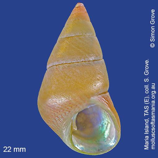
Typical shell-length 18 mm. Worn specimens are difficult to distinguish from P. irisodontes, though this species (if indeed distinct from P. irisodontes, grows significantly larger. Lives subtidally amongst seaweed, especially brown macroalgae. Native. Endemic to southeastern Australia (TAS, VIC and SA). In Tasmanian waters, this is a widespread species, although confirmed records are relatively few.
Classification
Class: Gastropoda
Subclass: Vetigastropoda
Order: Vetigastropoda
Superfamily: Trochoidea
Family: Trochidae
Subfamily: Cantharidinae
Genus: Phasianotrochus
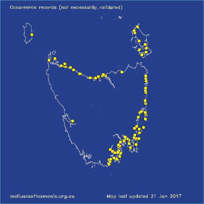
Localities for Phasianotrochus rutilus
Bangor: Lagoon Bay
Bangor: Two Mile Beach
Bay of Fires: Break Yoke Beach to Pebbly Beach
Beaumaris: Shelly Point
Bicheno
Bicheno: Redbill Beach
Bicheno: Waubs Beach
Blackman Bay: Little Chinaman Bay
Black River Beach: southern end
Boat Harbour: beach
Bridport (unlocalised)
Bruny Island (unlocalised)
Camdale: beach
Cape Barren Island: Bungs Beach
Cape Barren Island: Kenneth Point
Cape Barren Island: Kent Bay
Cape Barren Island (unlocalised)
Carlton: Park Beach
Chain of Lagoons: Four Mile Creek: beach
Clarke Island: Dip Point to Black Rocks
Clarke Island: Maclaines Bay
Clayton: foreshore
Coles Bay: foreshore
Coles Bay: Muirs Beach
Coles Bay (unlocalised)
Coningham: foreshore
Cooee Beach
Denison Beach: Porch Rocks
Denison Beach (unlocalised)
Dodges Ferry: Red Ochre Beach
Douglas River: beach
Eaglehawk Neck: eastern side
East Devonport: Pardoe Point
Falmouth: foreshore
Flinders Island: Killiecrankie: foreshore
Flinders Island: Lady Barron: Fisher Island
Flinders Island: Northeast River: mouth
Flinders Island: Tanners Bay
Flinders Island: Whitemark Beach
Freycinet Peninsula: Wineglass Bay
Garden Island Sands
Greens Beach: main beach
Hawley Beach
Hawley Beach: foreshore towards Point Sorell
Herlihys Bay: coast to E
Ida Bay (unlocalised)
King Island: Naracoopa: foreshore
Lauderdale: Roches Beach
Lauderdale: Seven Mile Beach
Macquarie Harbour: Kelly Basin
Margate foreshore
Maria Island: Hopground Beach
Maria Island: Oyster Bay
Maria Island: Trigonia Corner
Marion Bay: Bream Creek foreshore
Marion Bay: northern beaches
Mayfield Beach to Mayfield Point
Mercury Passage: Darlington Bay
Midway Point (unlocalised)
Narawntapu: Badger Beach
Narawntapu: West Head
Nine Mile Beach & Dolphin Sands
Nubeena: White Beach
Orford: Luther Point
Orford: Spring Beach
Orford (unlocalised)
Pirates Bay: Fossil Island
Pirates Bay (unlocalised)
Planters Beach to Fishers Point
Point Sorell: Margaret Rocks
Port Arthur: Denmans Cove
Port Huon (unlocalised)
Primrose Sands
Recherche Bay
Rocky Cape (unlocalised)
Schouten Island: Crocketts Bay
Schouten Island: Moreys Bay
Shearwater: Freers Beach
Sloping Main Beach
South Bruny Island: Adventure Bay: Two Tree Point
South Bruny Island: Adventure Bay (unlocalised)
South Bruny Island: Cloudy Bay Lagoon
South Bruny Island: Cloudy Beaches: eastern beach
Southport: Hythe Beach
Southport Lagoon: southern end
Stanley: Anthony Beach
Stanley: East Inlet
Stanley: Godfreys Beach
Stanley: Tatlows Beach
Stanley (unlocalised)
Swansea (unlocalised)
Tamar River: Kelso: foreshore
Taroona Beach
The Gardens: beach
The Gardens: Swimcart Beach
Tinderbox Beach
Turners Beach
Walker Island
Woodbridge: Flowerpot
Woolnorth: Woolnorth Point